🇬🇸 South Georgia
 National Flag
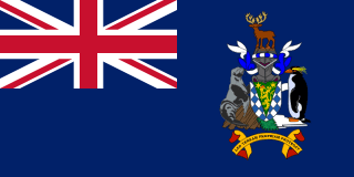
Geography & Borders
This country has no land borders.
Introduction & Background
South Georgia (Template:Lang-es) is an island in the South Atlantic Ocean that is part of the British Overseas Territory of South Georgia and the South Sandwich Islands. It lies around 1,400 kilometres (870mi) east of the Falkland Islands. Stretching in the east–west direction, South Georgia is around 170 kilometres (106mi) long and has a maximum width of 35 kilometres (22mi). The terrain is mountainous, with the central ridge rising to 2,935 metres (9,629ft) at Mount Paget. The northern coast is indented with numerous bays and fjords, serving as good harbours.
Discovered by Europeans in 1675, South Georgia had no indigenous population due to its harsh climate and remoteness. Captain James Cook in HMSResolution made the first landing, survey and mapping of the island, and on 17 January 1775 he claimed it a British possession, naming it "Isle of Georgia" after King George III. Through its history, it served as a whaling and seal hunting base, with intermittent population scattered in several whaling bases, the most important historically being Grytviken. The main settlement and the capital today is King Edward Point near Grytviken, a British Antarctic Survey research station, with a population of about 20 people.
Minerals
No mineral species have their type localities (original discovery site) defined within South Georgia in the Wikidata database. Explore other galleries to view geographic and climate data.
Flora & Flowers
South Georgia is home to a diverse range of plant species. Explore some of the native plants and flowers found in South Georgia below:
Loading plant species...
Animals & Wildlife
South Georgia is home to a diverse range of animal species. Explore some of the native animals and wildlife found in South Georgia below:
Loading animal species...
Music Albums
Explore the top 30 most-played music albums in South Georgia, sourced from Apple Music charts:
Loading music charts…