Land
Home
Continents
  • All Galleries
  • Elevation Maps
  • Minerals
  • Flora & Flowers
  • Animals & Wildlife
  • Climate Change
  • Music Albums
Home
Continents
  • All Galleries
  • Elevation Maps
  • Minerals
  • Flora & Flowers
  • Animals & Wildlife
  • Climate Change
  • Music Albums
  • Oceania

    • Oceania
    • Oceania Elevation
    • Oceania Minerals
    • Oceania Flora & Flowers
    • Oceania Animals & Wildlife
    • Oceania Music Albums
    • Oceania Climate Change
    • American Samoa
    • Australia
    • Christmas Island
    • Cocos (Keeling) Islands
    • Cook Islands
    • Fiji
    • French Polynesia
    • Guam
    • Kiribati
    • Marshall Islands
    • Micronesia
    • Nauru
    • New Caledonia
    • New Zealand
    • Niue
    • Norfolk Island
    • Northern Mariana Islands
    • Palau
    • Papua New Guinea
    • Pitcairn Islands
    • Samoa
    • Solomon Islands
    • Tokelau
    • Tonga
    • Tuvalu
    • Vanuatu
    • Wallis and Futuna
  • All Continents

🇼🇫 Wallis and Futuna
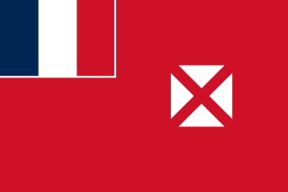
Flag of Wallis and FutunaNational Flag

Geography & Borders

This country has no land borders.

Introduction & Background

Wallis and Futuna, officially the Territory of the Wallis and Futuna Islands3 (/ˈwɒlɪs...fuːˈtuːnə/; Template:Lang-fr Template:IPA-fr or Territoire des îles Wallis-et-Futuna, Fakauvea and Fakafutuna: ʻUvea mo Futuna), is a French island collectivity in the South Pacific, situated between Tuvalu to the northwest, Fiji to the southwest, Tonga to the southeast, Samoa to the east, and Tokelau to the northeast.

Mata Utu is its capital and largest city. Its land area is 142.42km2 (54.99sqmi). It had a population of 11,558 at the 2018 census (down from 14,944 at the 2003 census).14 The territory is made up of three main volcanic tropical islands and a number of tiny islets. It is divided into two island groups that lie about 260km (160mi) apart: the Wallis Islands (also known as Uvea) in the northeast; and the Hoorn Islands (also known as the Futuna Islands) in the southwest, including Futuna Island proper and the mostly uninhabited Alofi Island.

Overview
AttributeDetails
Official Name
Territory of the Wallis and Futuna Islands
Capital
Mata-Utu
Continent
Oceania
Region / Subregion
Oceania / Polynesia
Population
11,620
Area
142 km²
Languages
French
Currencies
CFP franc (₣) [XPF]
Cost of Living
50 / 100 (Moderate)
Price per Coffee
$2.50
Price per Meal
$11.25
Timezones
UTC+12:00 (WFT)
Bounding Box
Min: (13.353884164848035° S, 176.25499817857678° W)
Max: (13.246115835151967° S, 176.1450018214232° W)
Climate
Tropical / Warm
Terrain
Vast dry deserts and plains, volcanic islands with rugged mountains, and coral atolls
GDP (Nominal)
N/A
GDP (PPP)
N/A
GDP Growth Rate
N/A
Macroeconomic Overview
Economic and macroeconomic profiles for Wallis and Futuna are detailed under national and global statistical registries.

Geography & Climate


  • Map Locations: Google Maps | OpenStreetMap

Minerals

No mineral species have their type localities (original discovery site) defined within Wallis and Futuna in the Wikidata database. Explore other galleries to view geographic and climate data.

Flora & Flowers

Wallis and Futuna is home to a diverse range of plant species. Explore some of the native plants and flowers found in Wallis and Futuna below:

Loading plant species...

Animals & Wildlife

Wallis and Futuna is home to a diverse range of animal species. Explore some of the native animals and wildlife found in Wallis and Futuna below:

Loading animal species...

Music Albums

Explore the top 30 most-played music albums in Wallis and Futuna, sourced from Apple Music charts:

Loading music charts…


← Back to Oceania

Prev
Vanuatu