🇹🇱 Timor-Leste
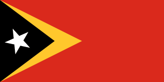 National Flag
Geography & Borders

Introduction & Background
East Timor (/ˈtiːmɔːr/ⓘ), also known as Timor-Leste (/tiˈmɔːr ˈlɛʃteɪ/; Template:IPA-pt), officially the Democratic Republic of Timor-Leste, is an island country in Southeast Asia. It comprises the eastern half of the island of Timor, the exclave of Oecusse on the island's north-western half, and the minor islands of Atauro and Jaco. Australia is the country's southern neighbour, separated by the Timor Sea. The country's size is 14,874 square kilometres (5,743sqmi). Dili is its capital and largest city.
East Timor came under Portuguese influence in the sixteenth century, remaining a Portuguese colony until 1975. Internal conflict preceded a unilateral declaration of independence and an Indonesian invasion and annexation. Resistance continued throughout Indonesian rule, and in 1999 a United Nations–sponsored act of self-determination led to Indonesia relinquishing control of the territory. On 20 May 2002, as Timor-Leste, it became the first new sovereign state of the 21st century.
Minerals
No mineral species have their type localities (original discovery site) defined within Timor-Leste in the Wikidata database. Explore other galleries to view geographic and climate data.
Flora & Flowers
Timor-Leste is home to a diverse range of plant species. Explore some of the native plants and flowers found in Timor-Leste below:
Loading plant species...
Animals & Wildlife
Timor-Leste is home to a diverse range of animal species. Explore some of the native animals and wildlife found in Timor-Leste below:
Loading animal species...
Music Albums
Explore the top 30 most-played music albums in Timor-Leste, sourced from Apple Music charts:
Loading music charts…